Colorado River Map: Where Does the Colorado River Start & End?
Our state’s namesake, the Colorado River (so named for the reddish silt in its waters), is one of America’s longest and most important rivers.
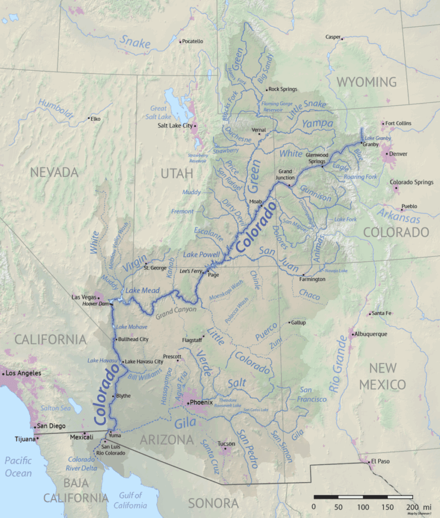
Stretching over 1,450 miles from its headwaters in the Rockies to its outlet in the Gulf of California, it flows through seven states, supplies water to roughly 40 million people, and irrigates a huge portion of the American West.

Here in Colorado, the river is vitally important to cities on the western slopes, where it supports local farms (including the famous Palisade Peaches!), provides drinking water, and drives tourism through rafting and other recreation, including hiking and watersports on the reservoirs.
Where Does the Colorado River Start?
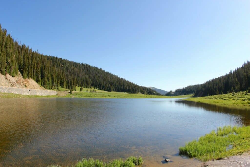
The Colorado River starts at La Poudre Pass Lake, a small alpine lake tucked inside Rocky Mountain National Park in northern Colorado near the town of Kemmerling. Fed by melting snow from the Never Summer Mountains, the river begins as a small mountain stream before it grows gradually.
From La Poudre Pass Lake, the water flows southwest into Grand Lake, Colorado’s largest natural lake, and then Lake Granby, a major reservoir used for water storage and recreation.
These lakes form part of the Colorado River Headwaters Byway, an 80-mile scenic drive that follows the river’s early path through mountain valleys and rugged terrain.
This section of the river, part of the Upper Basin, is known for its clear water, forested surroundings, and access to hiking, fishing, and wildlife viewing.
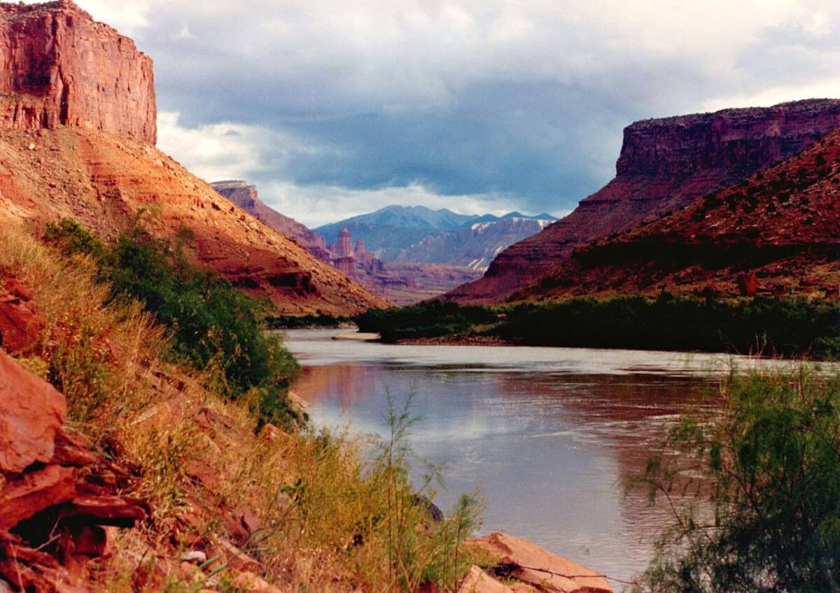
From Lake Granby, the river flows south and west, through Gore Canyon (a challenging and technical whitewater rafting destination that drops 68 feet per mile) and eventually through Glenwood Canyon.
The Glen Canyon Dam supports Lake Powell, the country’s second largest reservoir (behind only Lake Mead, a few hundred miles further downstream).
The Lower Basin
After Lake Powell, the river crosses Lees Ferry, where water rights are legally divided between the Upper Basin and the Lower Basin. The Lower Basin is one of the most heavily managed sections of the river, home to the Hoover Dam and Lake Mead, which supply water and power to more than 25 million people.
The full capacity of Lake Mead is 28.23 million acre-feet of water or 1,229 feet above sea level, which it last reached in the summer of 1983.
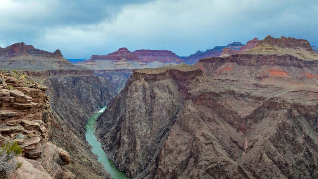
What river runs through the Grand Canyon?
The Grand Canyon is also in the Lower Basin (upstream of Lake Mead), where the Colorado River flows for 277 miles.
Where Does the Colorado River End?
The Colorado River outlets into the Gulf of California, between the Mexican states of Baja California and Sonora. However, the river today often ends several miles short of the sea due to heavy water use throughout the Southwest.
By the time the Colorado River reaches Mexico, less than 10% of its water remains due to miles of dams, diversions, and irrigation systems in the US. The river’s delta has drastically shrunk and nearly disappeared, made worse by years of drought, small snowpack, and higher temperatures that lead to increased evaporation.
Environmental and Political Impact
The Colorado River is a lifeline for the West, but growing demand and shrinking water supply have made it a source of conflict.
The Colorado River Compact, signed in 1922, divided water between seven states based on flow estimates that were too high. Today, the river carries less water than expected and populations dependent on the Colorado have grown significantly, leading to constant scarcity of water and conflict over usage rights.
Recreation on the Colorado River
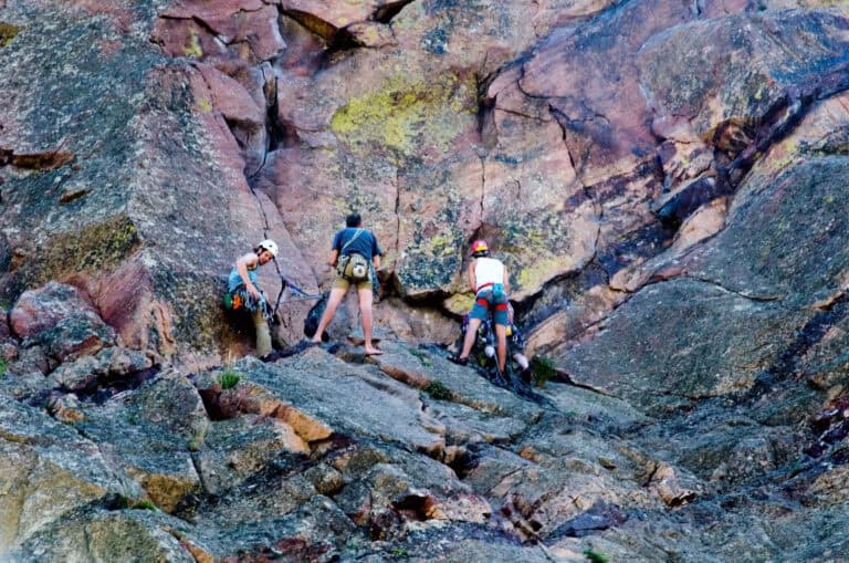
The Colorado River is also a major destination for outdoor recreation in Colorado. From scenic highways to thrilling whitewater, the river offers a wide variety of recreation opportunities.
Whether you’re driving alongside the headwaters or launching a raft into a canyon, this stretch of the river is beautiful and easily accessible.
Colorado River Headwaters Byway
The Colorado River Headwaters Byway covers 80 miles between Grand Lake and State Bridge. The route winds through mountain valleys, canyons, and forests, following the river’s early path. It’s a favorite for fall colors, wildlife spotting, and roadside stops with views of the river.
Rafting and Public Access Areas
One of the most popular rafting zones is the stretch between Pumphouse and State Bridge. This section includes both calm floats and exciting rapids.
Downstream from State Bridge, the river sees fewer visitors, offering a quieter experience for fishing or paddling.
Frequently Asked Questions (FAQ)
How long is the Colorado River?
1,450 miles from Colorado to Mexico.
Does Denver use water from the Colorado River?
Yes. Denver diverts some water across the Continental Divide from the Colorado River basin to meet city needs.
Where does the Colorado River start?
The Colorado River starts at La Poudre Pass Lake in Rocky Mountain National Park.
What states does the river flow through?
The river flows through Colorado, Utah, Arizona, Nevada, California, and into Mexico. Wyoming and New Mexico also use water from the river, but it doesn’t flow through those states.
Where does the Colorado River end?
The river ends in Mexico, just short of the Gulf of California.
What is the Colorado River Headwaters Byway?
An 80-mile scenic route through the upper Colorado River valley.
Does the river run through the Grand Canyon?
Yes, the Colorado River runs through the Grand Canyon.