Longmont Weather Report Including Drought & Smoke – Jan 8, 2026 to Jan 15, 2026
Key takeaways
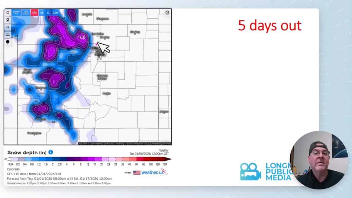
- Snow chances: Not much snow January 10 – 15.
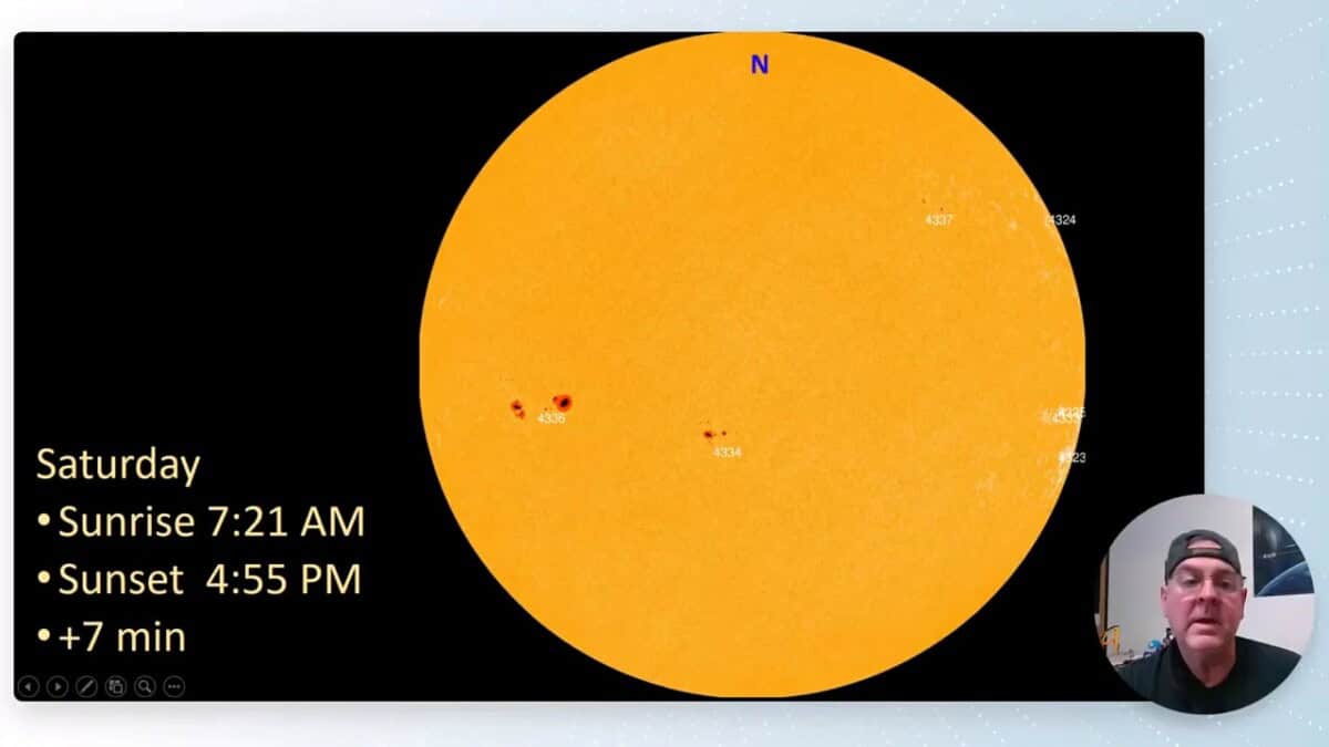
- Sunset time: Late afternoon darkness returns quickly — sunset backing up to about 4:55 p.m.
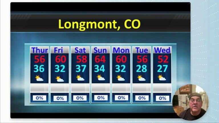
- Temperatures: Seasonal and above average temperatures.
- Drought and smoke: Record drought conditions remain a concern across the West, with occasional smoke touches locally at times.
- Regional pattern: Brief influences from the southwest and New Mexico will nudge colder air into the area between systems.
What to expect, day by day
Friday night, January 9th, will be the coldest stretch of the week. Plan for low temperatures dipping into the negatives in some locations. By Saturday the pattern looks to flatten out and return to more typical temperatures for this time of year.
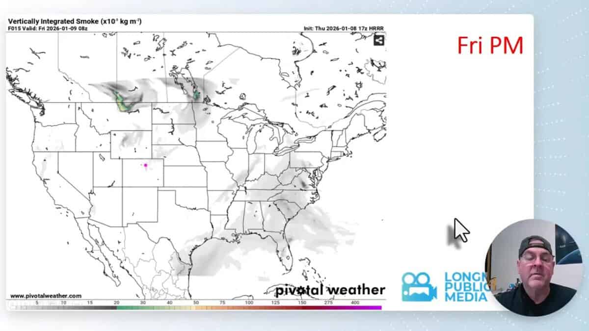
Drought, smoke, and regional influences
Drought conditions persist across much of the West, and that continues to shape the broader hydrology picture. Expect some dry pockets and water-resource concerns to remain in the background this season.
From time to time a touch of smoke or haze can drift into the area when winds bring it down from western wildfire zones. Locally, occasional smoke touches are possible but not a sustained problem this week.
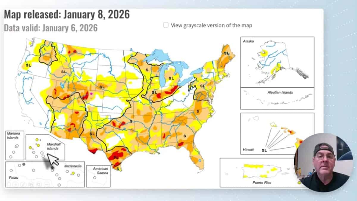
Drought Stress Continues
Front Range Faces Persistent Drought Stress as Snowpack Hits Record Lows
The Front Range of Colorado continues to grapple with significant drought conditions, raising concerns among water managers, farmers and urban planners about water supply reliability and long-term climate impacts. While some parts of the Western United States have seen improvements in drought status, Colorado’s key water indicators underscore persistent dryness and systemic risk for the year ahead.
As of mid-January 2026, Colorado’s statewide snowpack—a critical source of water for reservoirs, rivers and municipal supply—stands at approximately 62 percent of its historical median, with some southern basins below 50 percent of normal levels, according to recent assessments of snow water equivalent (SWE).
This represents the lowest statewide snowpack since systematic record-keeping began in 1987, posing a challenge to summer water availability and streamflow projections across the Front Range and beyond.
As of January 1, 2026, Colorado’s statewide snowpack (measured as snow water equivalent, SWE) is well below normal at approximately 57 percent of the median based on long-term SNOTEL and snow course data. It also notes that many individual SNOTEL sites with ≥ 20 years of data are reporting record low SWE levels relative to their own historical records.
Practical tips
- Travel: Jan 15-18 will be good travel weather.
- Cold nights: Protect outdoor pipes and be prepared for subzero lows Friday night in some spots.
- Visibility and air quality: If smoke/haze appears, those with respiratory issues should limit prolonged outdoor exertion.
- Stay flexible: Most systems are short-lived; a quick check in the morning can help plan the day.
FAQ
Is drought easing in the region?
Drought conditions remain present across the West. A few weak systems this week bring moisture to some areas, but they are not strong enough to significantly relieve long-term drought concerns.
Could smoke impact air quality locally?
Occasional touches of smoke or haze are possible when winds bring it down from western wildfire zones. Most of the week looks generally clear, but check local air quality updates if you have respiratory sensitivities.
Final notes
The week ahead blends a few short-lived storm passages with cooler nights and ongoing drought considerations. The most notable period will be around January 10 when snow pockets may deliver heavier totals than surrounding areas. Stay prepared for chilly nights and brief travel impacts over the weekend.