
Water Advisory Board September 2026: Reservoir Operations, Creek Improvements, Water Fees, and Conservation

Longmont’s water system manages a whole host of moving parts. It is about the water available today, certainly, but it is also about storage, water rights, infrastructure, environmental stewardship, development, affordability, and the choices that keep the community prepared decades from now.
The September 2026 Water Advisory Board meeting covered a wide range of topics, from current stream calls and reservoir levels to a detailed look at Ralph Price Reservoir and Button Rock Dam, the future of the Beckwith diversion corridor, development-related water requirements, the updated cash-in-lieu fee, and a community conservation campaign.
Table of Contents
- Water Status: Calls, Reservoir Storage, and Better Measurement
- Development Activity: Conveyance Plats and Raw Water Requirements
- Ralph Price Reservoir and Button Rock Dam: A Critical Longmont Asset
- Water Rights at Button Rock: Why So Many Decrees Matter
- How Button Rock Serves Longmont
- What Happened at Button Rock During the 2013 Flood
- Could Button Rock Be Enlarged?
- Beckwith Diversion and Creek Corridor Improvements
- Cash-In-Lieu Fee Set at $63,000 per Acre-Foot
- Water Rates and Long-Term Utility Planning
- Conservation: The My Water Plan Campaign
- Measuring the Results of Voluntary Conservation
Water Status: Calls, Reservoir Storage, and Better Measurement
Water administration on the St. Vrain system remains active. Calls were in place on the main stem, on Left Hand Creek, and on Lyons Ditch. A call determines which water rights may divert water and which supplies must remain in the stream for senior users.
At the time of the report, the Lyons gauge recorded about 23.4 cubic feet per second, or roughly 53.6 percent of historical average flow. Demands on Left Hand Creek had been declining, which meant the call there could potentially change or come off.
Reservoir storage remained an important part of the operating picture:
- Union Reservoir was approximately 53.2 percent full, holding about 6,797.5 acre-feet.
- Ralph Price Reservoir at Button Rock was approximately 96.3 percent full, holding about 15,709 acre-feet.
Staff also continues to work with Northern Water and other users on Dry Creek flow discussions. A major focus is improving the data available for water administration through new telemetry and measurement infrastructure. Planned work includes telemetry posts at Meadow Ditch near Lyons and Reese Styles, along with additional coordination involving the Cushman Ditch, Chaplin Ditch, and other locations.
That kind of equipment is not glamorous, but it matters. Accurate, real-time measurements are what allow water managers to know what is physically available, administer water rights correctly, and make decisions without guessing.
Development Activity: Conveyance Plats and Raw Water Requirements
The board reviewed six development-related items, all of which were in compliance with Longmont’s groundwater requirement policy. Three conveyance plats required formal board recommendations to City Council:
- 701 South Main
- Front Range Community College
- Longmont Transit Center Filing No. 1
The board recommended approval of all three.
These are primarily property and planning actions, not immediate new water demands. The 701 South Main item involved dedication of additional right-of-way along Grand Avenue. The other plats relate to future activity around the community college and transit center area south of First Avenue and around Main Street.
What Is a Conveyance Plat?
A conveyance plat is a useful planning tool, but it comes with a big asterisk.
It allows a landowner to create and transfer a parcel without first resolving the raw water deficit associated with future development. The buyer can acquire the property, but the parcel cannot be developed until the necessary water requirements are met through a subsequent development process or an existing approved plat.
In plain terms: a conveyance plat allows a property sale, not construction.
This differs from a standard development plat, where the raw water requirement must be satisfied before development can proceed. The distinction gives property owners flexibility while preserving the city’s water supply standards.
Why Replats Can Appear Years Later
Several of the informational items were replats of land that had already been annexed and platted. Replats can occur for many ordinary reasons: combining lots, dividing a lot, changing acreage, adjusting a site plan, or responding to economic conditions.
Development review is also an iterative process. Multiple city departments review a plan, provide comments, receive revisions, and review again. A project may move through five, six, or more rounds of review before it reaches a later stage. During that process, acreage and development assumptions can change, which can affect the total water deficit even when the per-acre requirement itself does not change.
Ralph Price Reservoir and Button Rock Dam: A Critical Longmont Asset
Ralph Price Reservoir, held behind Button Rock Dam, is one of Longmont’s most important water assets. It is wholly owned by the City of Longmont, which gives the city direct control over operations and makes the reservoir enormously valuable in a complicated water system.
Construction took place from 1967 through 1969. The original project cost was about $5.2 million, a figure that is almost hard to comprehend in light of current construction costs.
Some basic facts put the reservoir into perspective:
- The dam is approximately 200 feet high.
- The reservoir stores just over 16,000 acre-feet.
- At full pool, it covers about 219 surface acres.
- The reservoir has roughly 5.7 miles of shoreline.
- The spillway can pass approximately 32,500 cubic feet per second.
- Combined outlet capacity is approximately 865 cubic feet per second.
Longmont operates the reservoir through two broad seasons. During the non-irrigation season, stored water helps meet winter municipal demands. During runoff, generally May through early July, the city refills the reservoir using its changed water rights and other available supplies.
How Releases Are Managed
When water is entering the reservoir, the city often has an obligation to pass flows downstream. During a call on the river, incoming water that Longmont is not legally entitled to store must be released. The city also releases stored water needed by the water treatment plant.
That is a daily operating challenge. Reservoir staff adjust releases as needed, while water accounting staff track water rights, inflows, storage, consumptive use, replacement obligations, and municipal demand.
The accounting is not a simple reservoir-level calculation. It includes more than 40 decrees associated with the reservoir, hundreds of rows of daily information, and dozens of interconnected accounting sheets. The city uses a pressure transducer capable of reading water level to a very fine degree and applies a rating curve to estimate storage volumes accurately.
It is especially helpful when the reservoir is spilling, because the river is then being passed through the system rather than stored. The difficult work is managing changing contents and releases precisely when the reservoir is not spilling.
Water Rights at Button Rock: Why So Many Decrees Matter
Button Rock’s own storage decrees are relatively junior. The principal decrees date from 1910, 1926, and 1964, with a conditional enlargement decree of approximately 32,551 acre-feet carrying the 1964 priority date.
But the reservoir can also store water under many other decrees. That is where the real flexibility comes from.
Direct-Flow Change Decrees
Many of Longmont’s changed water rights were historically irrigation rights. Through water court, the city has changed those rights to allow municipal use and, in many cases, storage at alternate locations such as Ralph Price Reservoir.
These include very senior rights, with some priorities reaching back to the 1860s. The direct-flow change decrees are core operating tools during the runoff season. They allow Longmont to capture legally available water and put it to work for municipal supply.
Upper and Lower Transfers
Longmont’s changed rights are often described by their geographic relationship to the St. Vrain system.
Upper transfers include rights associated with the Smead, Longmont Supply, Palmerton, Oligarchy, Rough and Ready, and related ditches. Some original change cases were initiated in 1981 and completed in 1983, while later changes followed in 1987 and 2000.
Lower transfers include rights associated with Beckwith, Pella, South Flat, Swope and Turner, Nye White, and Clover Basin Ditch. These illustrate how long water court work can take. Some were initiated in 1987 but were not fully completed until around 2000.
The point is simple: water projects and water-right changes are not quick. A process that once could take a few years can now take well over a decade.
High Mountain Dams and Alternate Storage
Longmont also holds storage decrees tied to former high-mountain reservoirs, including Bluebird, Pear, and Sandbeach. These structures were located in what became Rocky Mountain National Park. Under agreements with the National Park Service, the dams were removed and the sites returned to natural lakes.
The water rights did not disappear. Instead, Longmont changed the points of storage so those decrees could be used at locations including Button Rock and Pleasant Valley Reservoir.
Other storage decrees associated with Pleasant Valley, Birch Lake, and Union Reservoir can also be stored at Button Rock when conditions and priorities allow. This gives Longmont the flexibility to manage water across the entire system, especially during drought or periods when keeping supplies high in the system is most valuable for municipal use.
How Button Rock Serves Longmont
Button Rock is not just a reservoir. It is a central operating tool for the city’s water supply.
- Municipal water treatment: When direct flow is unavailable because of a severe river call, stored water can meet treatment plant demand.
- Runoff-season storage: The reservoir captures water when changed rights are in priority and physically available.
- Replacement water: Releases can help satisfy historical return-flow obligations associated with changed water rights.
- Recreation: The Button Rock Preserve supports fishing, hiking, picnicking, and access to a remarkable landscape.
- Operational flood moderation: The reservoir is not a flood-control project, but managed storage can sometimes reduce runoff peaks and provide valuable time for downstream preparation.
That last point deserves care. Button Rock was not designed or operated as a dedicated flood-control reservoir. Still, if staff know a large runoff is coming, maintaining some available storage space can help soften the effect of a rising hydrograph downstream.
Longmont is fortunate to have this on-channel reservoir. Building something similar today would face immense cost, environmental review, legal hurdles, and permitting challenges. The foresight behind this project continues to serve the community many decades later.
What Happened at Button Rock During the 2013 Flood
The 2013 flood remains an important test of the dam and spillway design.
Before the peak flood arrived, conditions were already serious. The ground was saturated, rainfall was heavy in the upper watershed, and releases had been increased from a more typical level around 50 cubic feet per second to several hundred cubic feet per second.
As the reservoir level rose rapidly, staff considered opening the outlet farther. Ranger staff were in communication with water operations personnel, but the spillway conditions became dangerous. It was dark, the ground was shaking, and traveling across the spillway was not safe.
In the end, the additional outlet flow would not have materially changed the outcome. The flood was passing roughly 20,000 to 30,000 cubic feet per second over the spillway. Adding several hundred cubic feet per second through the outlet would have been insignificant compared with that scale of flow.
The important outcome was that the dam and spillway performed exceptionally well. The spillway and outlet are separated by the mountain, an important design feature that helped the system perform as intended under extreme conditions.
Read next: How Longmont Became America’s Only United Nations Resilience Hub
There was scour and damage in the outlet area and extensive downstream damage, including loss of road sections and damage along North St. Vrain Creek. Longmont Reservoir downstream captured a substantial volume of sediment. That sediment was later excavated and reused to help rebuild the road toward Button Rock, avoiding the much greater cost of importing material from farther away.
The 2013 event was devastating, but it also demonstrated the value of careful engineering, ongoing communication, emergency mobilization, and resilient infrastructure.
Could Button Rock Be Enlarged?
Longmont holds a conditional enlargement decree, but a future enlargement is not a near-term project.
Any enlargement would face serious practical barriers: land ownership, environmental impacts, permitting, legal challenges, and the difficulty of developing a new or expanded on-channel project. Similar projects elsewhere in northern Colorado have spent decades in permitting and litigation.
Longmont will continue protecting the value of its conditional right through due diligence. But even if there is a future need, an enlargement is likely a project measured in decades, not a quick fix.
Beckwith Diversion and Creek Corridor Improvements
The Beckwith diversion is located around Golden Ponds, near a well-known waterfall and pedestrian bridge. It is a beautiful spot, but it is also a complicated piece of water infrastructure.
The Beckwith Ditch holds one of the oldest and most senior rights on the St. Vrain, dating to 1861. Longmont owns 215 of the ditch company’s 217 shares, with the remaining two shares held by developers and expected to transfer eventually as part of water-deficit obligations.
The historical irrigation diversion rate is 14 cubic feet per second, and the long-term average diversion is a little over nine acre-feet per share.
The Beckwith Change Case
Longmont previously changed just under half of its Beckwith shares in a 1987 water court case. A new case, identified as 24CW3143, seeks to change the remaining 121.66 shares. Once completed, all 217 shares will have municipal-use authority in addition to irrigation use.
The requested uses include municipal supply, alternate points of diversion, alternate points of storage, and bypass-flow credits. The goal is to use water directly for treatment early in the season, store water when conditions allow, and create in-stream credits later in the irrigation season.
Why Measuring Low Flow Is the Key Issue
The unresolved issue is not whether Beckwith is senior. It is. The challenge is proving the physical availability of water at the exact diversion location during low-flow periods.
Longmont is a gaining stream, meaning return flows and groundwater contributions can add water as the stream moves through town. Historically, the Beckwith diversion could take that water regardless of whether the molecules originated in the mountains or returned to the system farther downstream.
At certain times, however, a calculation at the downstream state gauge may show a theoretical zero-flow point. That does not necessarily mean no water exists at the Beckwith location. It means the available flow must be measured and documented well enough for the State Engineer’s Office to administer the decree.
An existing metal V-notch measuring structure and concrete wings at the site may provide a solution. The objective is not necessarily to measure high flows. The important question is whether the city can prove that two, three, or four cubic feet per second are physically present during late summer and early fall.
If Longmont can measure that flow and establish it is legally available, the city could use it for bypass credits. That means less need to release water from Union or Button Rock simply to satisfy obligations. In practical terms, it could help preserve reservoir storage longer into the season.
Why the Corridor Work Will Take Time
Future work in this reach must solve several problems at once:
- Maintain legal and measurable water administration.
- Improve fish passage and aquatic connectivity.
- Protect or adapt diversion functions for Beckwith, Cushman, and Island ditches.
- Address a major drop at the diversion structure.
- Consider recreation, including boating access and public safety.
- Coordinate with landowners, ditch companies, Boulder County, state agencies, conservation groups, and funding partners.
The Beckwith structure is a joint diversion, not a single-purpose facility. Removing or reshaping the existing drop could improve fish passage, but the system must still deliver water where it is legally required to go and preserve a reliable measuring location.
This is a multi-phase effort. The city is participating in the St. Vrain and Left Hand Creek Basin Collaborative and the Passage Playbook process with many partners. Before physical work begins, the water court decree needs to be completed and the group must agree on a workable design, funding strategy, measurement approach, and implementation plan.
That means work in the channel is still likely several years away. It is a complex project, but the potential benefit is substantial: more flexible municipal water management, better ecological passage, and a better-functioning creek corridor.
Cash-In-Lieu Fee Set at $63,000 per Acre-Foot
City Council approved the Water Advisory Board’s recommended increase to the cash-in-lieu fee. The fee will rise from $59,625 per acre-foot to $63,000 per acre-foot, effective January 1, 2027.
Cash-in-lieu is part of Longmont’s raw water requirement policy. When development cannot dedicate qualifying water rights to serve its demand, the developer may pay a fee that helps the city secure future water supply.
The fee matters because it must reflect the real cost of maintaining a dependable long-term water supply. That can include acquiring water rights, developing storage, building conveyance infrastructure, or pursuing other supply projects. Water is not a simple commodity in this system, and the cost of securing new reliable supply is shaped by construction, legal, environmental, and market realities.
The timing change is important too. Rather than taking effect immediately after City Council action, the new fee will take effect on January 1. That gives staff and developers a known timeline and avoids last-minute uncertainty around pending transactions.
What Comes Next for the Fee Review
The board will continue reviewing the fee quarterly under the raw water requirement policy, with annual recommendations generally developed in June and presented to City Council in the fall for a January effective date.
Future reviews will consider updated costs for potential supply projects, particularly the enlargement of Union Reservoir and a Union Reservoir pumpback pipeline. These projects may help inform what it would cost to add future supply, even if the city is not actively constructing them today.
Water Rates and Long-Term Utility Planning
The board also looked ahead to a future conversation about customer water rates. The immediate purpose is informational: to explain already approved rate changes and what customers can expect on January 1, 2027.
The broader question is how future rate adjustments relate to capital improvements, cost-of-service studies, operating needs, and major water investments. Board members emphasized the value of understanding the full picture, especially as Longmont considers significant infrastructure needs over time.
The Water Advisory Board is advisory, but its role is still meaningful. It brings an informed public perspective to difficult decisions involving water supply, capital projects, conservation, and long-range planning.
Conservation: The My Water Plan Campaign
Longmont is also asking the community to help conserve water through the My Water Plan campaign.
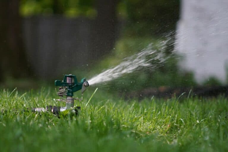
The centerpiece is a voluntary commitment to turn off automatic outdoor irrigation systems by October 1. Participants who make that commitment can qualify for a $50 bill credit.
The campaign also provides other conservation choices for households that do not have irrigation systems or cannot make the October 1 pledge. Actions include practical changes such as shorter showers and turning off the tap while brushing teeth. The tool estimates the potential water savings associated with selected actions and creates a personalized conservation plan.
Turning off automatic irrigation does not mean ignoring trees. Hand watering may still be needed depending on weather and soil moisture conditions. The focus is on ending automatic lawn irrigation as the outdoor growing season winds down.
Free yard signs are also available with messages such as “I’m saving water for Longmont” and “I’m putting my grass to bed early.”
Measuring the Results of Voluntary Conservation
The board asked for a future report on how well Longmont performed under its voluntary conservation goals. That report will need to account for more than a simple year-over-year comparison.
Weather matters. A hot, dry summer with long stretches of 100-degree temperatures naturally increases outdoor water demand. An extended warm fall can also affect the numbers because irrigation may continue later than in a typical year.
Still, the early impression was that many city operations, especially parks and golf, made meaningful progress. Once the irrigation season concludes, staff expects to return with a more complete analysis of actual savings, treated and untreated water use, weather conditions, and performance against the community goal.
That feedback matters because conservation is not only about one season. It helps Longmont understand what voluntary behavior change can achieve, where additional education may be helpful, and how prepared the city is if conditions ever require stronger restrictions.
Frequently Asked Questions
What is the new Longmont cash-in-lieu water fee?
The fee will be $63,000 per acre-foot beginning January 1, 2027. It was previously $59,625 per acre-foot.
What is a conveyance plat?
A conveyance plat allows a parcel to be created and transferred without immediately satisfying its raw water deficit. The parcel cannot be developed until the applicable water requirements are met.
How much water can Ralph Price Reservoir store?
Ralph Price Reservoir at Button Rock stores just over 16,000 acre-feet when full.
Is Button Rock Dam a flood-control project?
No. Button Rock was not designed as a dedicated flood-control reservoir. However, reservoir operations can sometimes provide limited runoff moderation by preserving storage space when large flows are anticipated.
Why is the Beckwith diversion project important?
The project could improve Longmont’s ability to measure and use a very senior water right for municipal supply and bypass credits, while also addressing fish passage, diversion infrastructure, creek restoration, and recreation issues.
What is the My Water Plan campaign?
My Water Plan is Longmont’s conservation campaign encouraging residents to reduce water use. Those who commit to turning off automatic irrigation by October 1 may qualify for a $50 bill credit, while other conservation actions can also be included in a personalized plan.